Key points
- Hegra (Al-Hijr) became Saudi Arabia’s first UNESCO World Heritage Site in 2008.
- It is the largest conserved Nabataean site south of Petra, with more than 100 monumental tombs carved into sandstone outcrops.
- In a heritage landscape, the trail design starts with what must be protected, then finds the line people will walk.
- Every alignment was scouted on foot before it was drawn.
Some places ask a trail designer to be bold. Hegra asks for the opposite. Two thousand years ago the Nabataeans carved their tombs into the sandstone outcrops of this plain, north of AlUla. Today the site is Saudi Arabia’s first UNESCO World Heritage Site, and every footstep around it needs a reason.
A landscape that decides for you
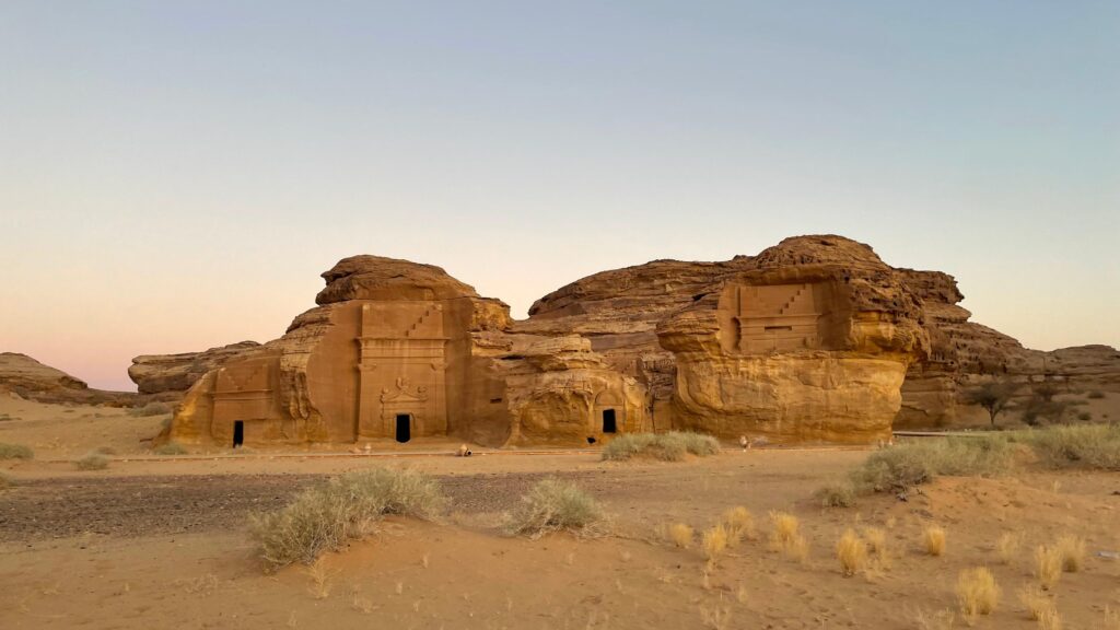
Hegra was a southern city of the Nabataean kingdom, the same people who built Petra. More than a hundred monumental tombs stand on the plain, many of them with carved façades, inscriptions and the signature stepped crowns of Nabataean architecture. The best known is Qasr al-Farid, the “Lonely Castle”, a single tomb cut into a free-standing rock. Between the outcrops lie soft sand, wind-shaped boulders and wide open views.
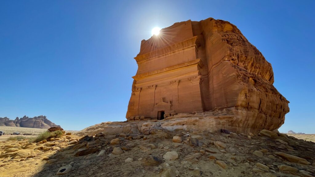
That combination makes Hegra extraordinary to walk through, and fragile. Sand moves. Soft rock wears quickly under feet. Inscriptions and carvings sit at hand height. So the first map we draw in a place like this is not a trail map. It is a map of everything a trail must avoid.
How we scouted
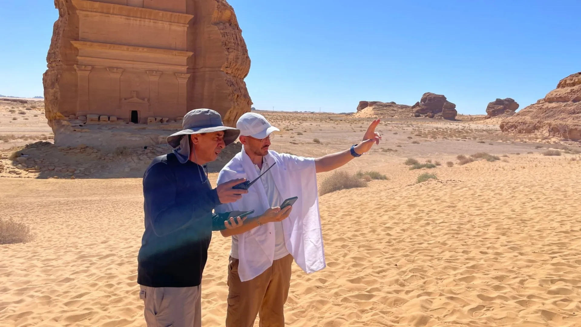
We work the same way everywhere: on foot first, at the desk second. In Hegra that meant walking every option with the heritage teams’ constraints in hand, in the morning and in the afternoon, to see how the light, the heat and the sand change the experience. We looked for natural lines between the outcrops, for places where visitors could stop and look without touching, and for viewpoints that reveal the scale of the site.
Each option was recorded with GPS tracks, photographs and notes on surface, shade, gradient and risk. Back at the desk, we compared them against the heritage constraints, the visitor flows planned for the site and the experience we wanted people to have.
Design principles for a heritage trail
- Distance from the monuments. Trails approach the tombs to reveal them, never to reach them. Viewpoints are chosen so that the best photograph is taken from the trail.
- Surfaces that do not need building. Where possible, the trail uses firm ground that already exists, rather than new construction that would change the landscape.
- Light wayfinding. Markers are few, low and in materials and colours that sit quietly in the scenery, following the destination’s signage system.
- Stories on the way. The Nabataeans, the incense route and the later Hejaz railway give each section a narrative, so the walk becomes the interpretation.
- Managed visitor flows. Routes are designed to spread people out and to work with the guided access that protects the site.
Why it matters
A heritage site is not a backdrop for a trail. It is the reason the trail exists. Getting the line right in Hegra means visitors leave with the feeling of having walked with the Nabataeans, and the site stays exactly as they found it.
Working on a heritage landscape that deserves the same care? Start a project →