Key points
- Wild Guanabana designs two map families: trail user maps for visitors, and trail audit maps for business teams and trail builders.
- In AlUla the colour palette follows landscape zones and AlUla’s County codes for signage and wayfinding.
- Hiking audit maps are drawn at 1:5,000 to 1:20,000 and delivered in ISO formats from A3 to A0.
- Every trail user package includes a map, difficulty, length, start and finish, seasonal advice and narrative themes.
A trail map is often the first thing a visitor sees of a destination, and the last thing they keep. It should feel like the place it describes. That is why Wild Guanabana designs its cartography for each destination rather than dropping routes onto a generic base map.
Inspired by the landscape
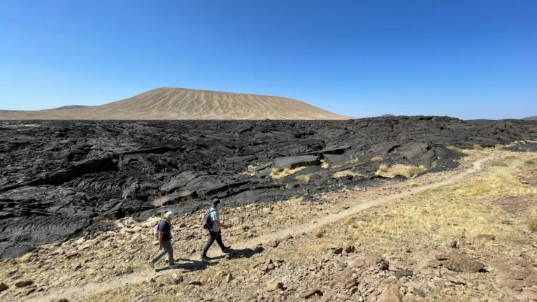
For the AlUla Adventure Trail Network, our map design started with a mood board drawn from the land itself: immersive viewscapes, the colours of the flora, the textures of the geology, the black volcanic harrats, the ancient inscriptions and the heritage of the oases. The colour palette is divided by landscape zone (protected areas, rural areas, canyons and desert, oasis and urban) and is consistent with AlUla’s County codes for signage and wayfinding, so maps, signs and waymarks speak the same visual language.
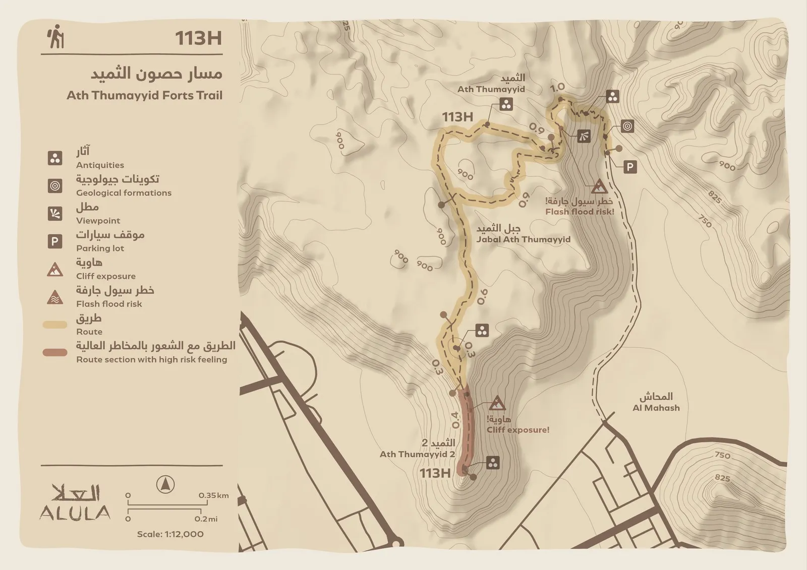
Two families of maps
Trail user maps are for visitors. Each one shows the route, points of interest, infrastructure, cautions and any higher-risk sections, and comes with a trail package: a short overview, the difficulty rating, length in time and distance, start and finish, seasonal recommendations, narrative themes and at least two photographs. They are designed to be viewed on a website or app, or printed.
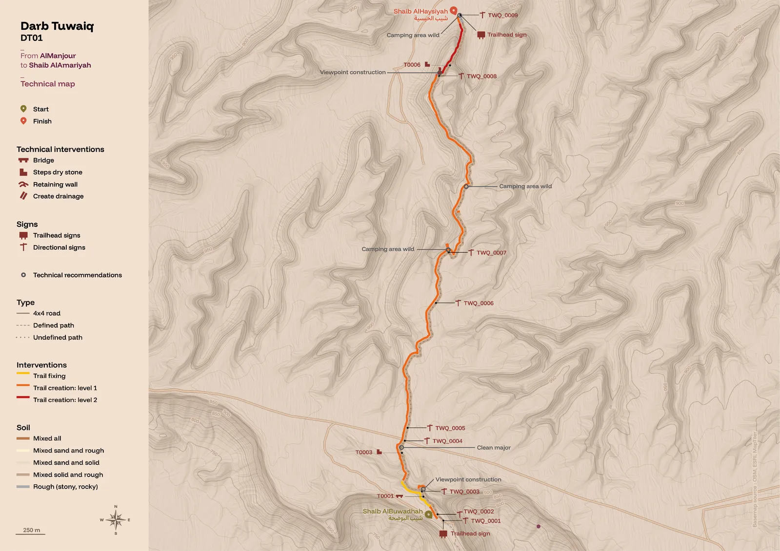
Trail audit maps are for the client’s business team and the trail builders. They show every technical intervention, the recommended infrastructure and amenities, access routes, soil types and path types. Hiking audit maps are drawn at scales between 1:5,000 and 1:20,000 and delivered in standard ISO layouts from A3 to A0.
A current project in the Riyadh region
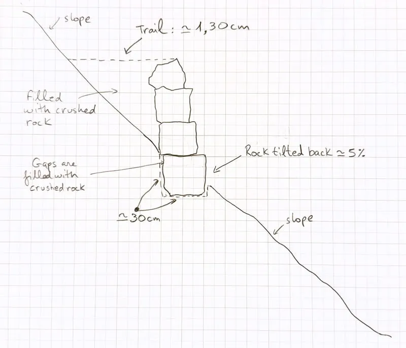
The same approach now shapes a trail project we are developing in the Riyadh region, not yet published. Bilingual Arabic and English trail user maps combine contour shading with clear route profiles. Alongside them, the audit maps locate each intervention, and some of the most delicate ones, such as dry-stone retaining walls on steep slopes, are first drawn by hand, from the field, so the builders see exactly what is intended.
From map to sign to screen
Because one team draws the maps, designs the signage and publishes the trails digitally, the same names, numbers and colours follow the visitor from the trailhead panel to the waymark, and from the printed map to the app on their phone.
Need trail maps that look and feel like your destination? Start a project →